
Before the cold weather and snow comes to the high country this year, I really wanted to get out and do something quintessentially Coloradan: hike a fourteener! What’s a fourteener, you ask. Well, it’s simple, it’s mountain peak that exceeds 14,000 feet! There are 53 fourteeners in Colorado, the most, by far, in the continental US.
We wanted to start with a fourteener that was on the easier side (as far as fourteeners go), and not too far of a drive, so we decided to climb Mount Bierstadt. We decided to take the most common and easier route to the summit, starting at the Bierstadt trail head, located off of Guanella Pass road, near Georgetown, CO. It took about 1 hour and 30 minutes to drive from Denver to the trail head.

It’s best to hit the trail early to avoid the chance of afternoon lightening that often pops up in the high country, so we got up and arrived at the trail head around 8:00 a.m. The trail head was already pretty crowded by that time, so if you are looking for some quiet solitude to hike in, Bierstadt is probably not your fourteener of choice.
Starting elevations: 11,669 feet
From the parking lot, the trail starts off downhill, which was a nice change of pace. A lot of hikes I have been on lead you up a very steep section of trail almost immediately. You hike down and across a marshy area, with small wooden foot bridges built over the swampy bits. Once you make it across the marsh, the climb begins. You wind up a series of switchbacks onto the first shoulder of the mountain. It’s then you can see the steep path to the top and all the work that still lies ahead.
And then the real hiking begins! The trail continues to be steep and a little rocky. It was slow going because of the incline, but also because of the altitude. We felt like we could never catch our breath and had to stop every 5-10 min and take a break. Most people hiking up the trail we’re doing the same thing and we ended up leap frogging with the same people almost all the way up to the summit.

Once you reach the final ridge at about 13,800 feet, the trail more or less disappears and you have to navigate your way up the rocks and boulders to the summit (see picture above). It’s relatively easy, low level scrambling. It actually felt nice to climb this section and give my burning quads a break!
Summit Elevation: 14,065 feet
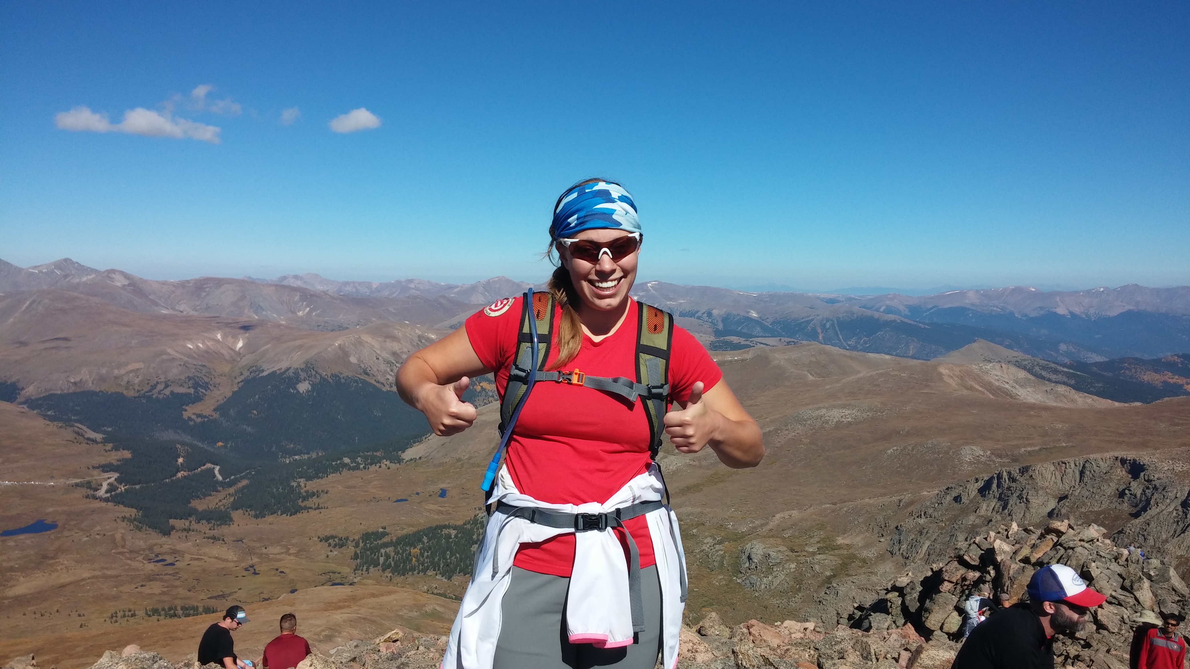
Before we knew it, we were at the summit! Which was surprisingly crowded, but awesome all the same! From the summit you can see Mount Evans and the saw tooth peaks that separate the two mountains. If you’re feeling really ambitious, you can hike/scramble across the saw tooth (saw teeth?) and over to Mount Evans.
The descent back down was a little slower than I expected as it took some concentration to navigate the rocky steep trail back down. Even then, I still managed to trip and bang my shin into a rock. I also managed to slip on a rock over the small stream crossing in the marshy area and half fall in. Overall, I was no worse for wear though!
At the bottom of the trail, I was so amazed and proud to look back at what we had just accomplished! That nice downhill at the start of course becomes an uphill on the way back. It wasn’t steep or challenging, our legs were just fried at that point. I was happy to make it back to the car and sit down.

Mid-September ended up being a beautiful time to hike up Bierstadt. The weather was great! It was about 40 degrees when we started and sunny. The strenuous hike ensures that you stay warm on the way up. We also lucked out in that there’s wasn’t too much wind. The hike down was sunny and warm, but not hot. We also got to see some of the leaves starting to change on the drive to/from the trail head.
Overall, it was a great, but challenging hike. I hope to squeeze in one more fourteener before the winter!

